Chatter News Photo Galleries & Information on Cat Skiing ____________________________________
| Chatter News | Road to Vertebrae Glacier | Glacier Skiing | Bombardier Snowcat | Favorites |
| Lodge Life | Vertebrae Lodge | Solitude Lodge | Happy Campers | Pink Purse | Winter Staff |
Ski Photography by: | John Dougall | Mark Gallup | Dan Hudson | About Us | Site Map | Index |
| Chatter Creek Cat Skiing | Clamshell | Cut Blocks | East Ridge | Lodge Ridge | Great Links |
| Cat Skiing Terrain | Cat Skiing Articles | Flight to Chatter Creek | Travel to Golden | Email |
Terrain Quick Links:  | South Side | West Side | Lodge Ridge | Megahooped | Glacier | East Ridge |

Wednesday, September 08, 2004

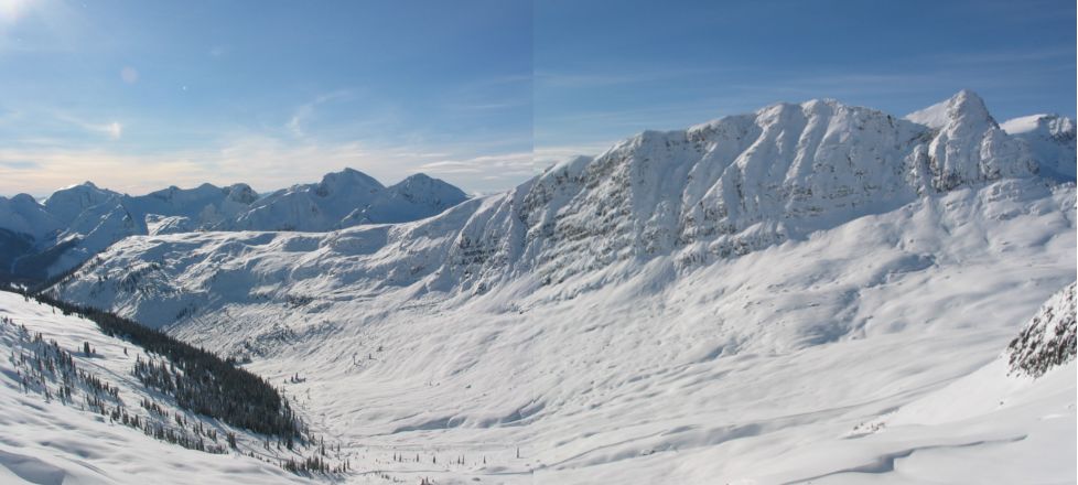
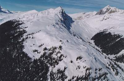
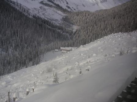
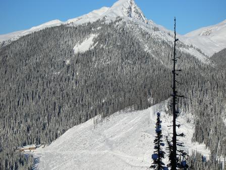
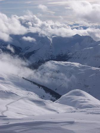
Lodge Ridge separates Stovepipe Mountain, containing Megahooped, Wonderland and Jo-Pal from the "West Ridge" containing the Clamshell, Fruit Loops and Staff Trees. Lodge Ridge rises from the Chatter Creek valley and the doorstep of Vertebrae Lodge . Its lower flank contains the Home Run cut block that forms a good part of the view from the lodge. Click the panorama to the right for a view from the south of Lodge Ridge in relation to Stovepipe Mountain.
                                        Return to Road Network Index

Lodge Ridge at Chatter Creek Cat Skiing

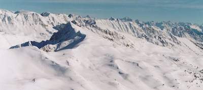
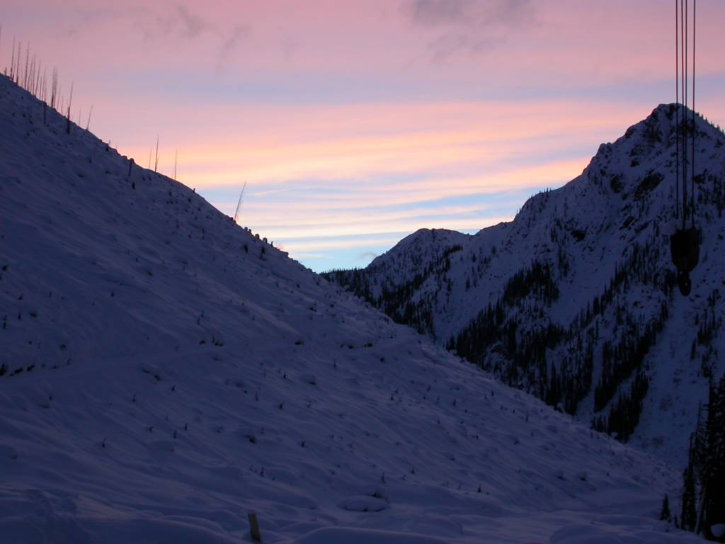
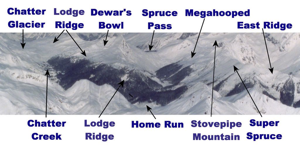
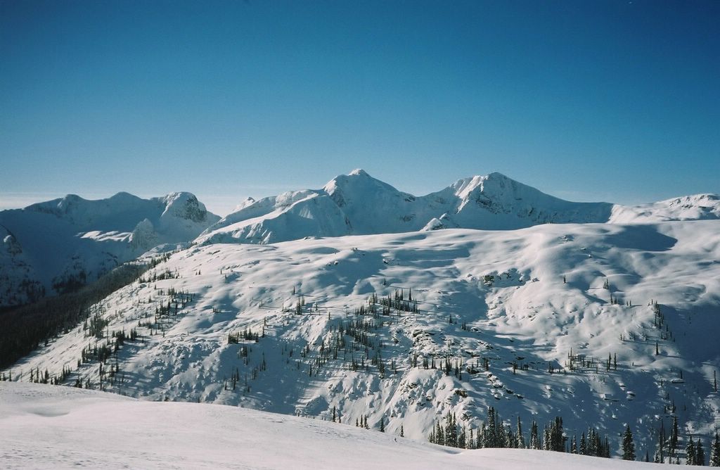
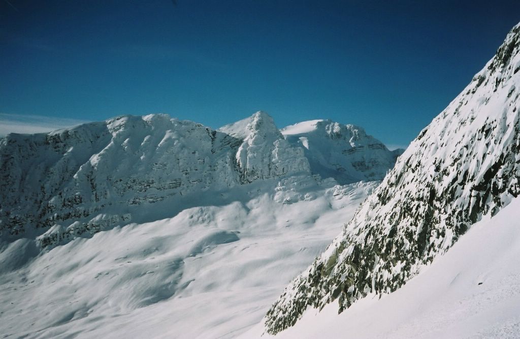
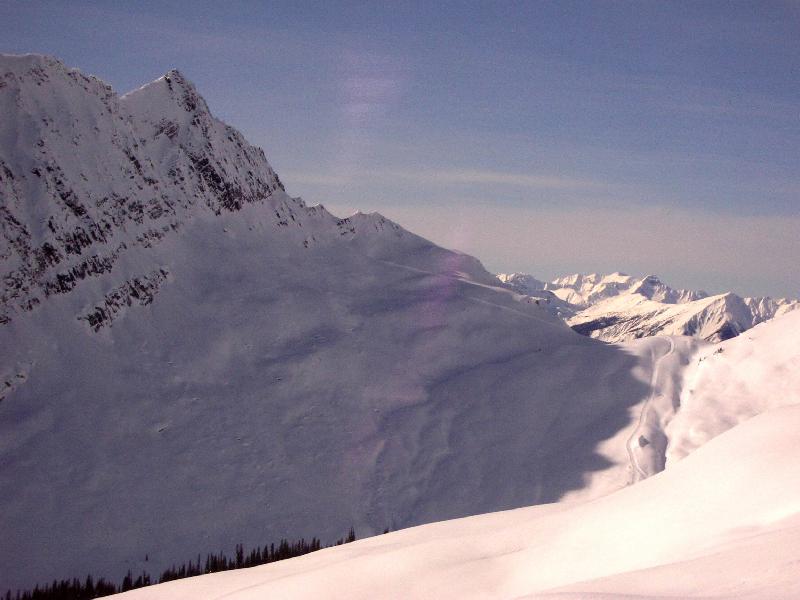
The road to Lodge Ridge leaves Vertebrae Lodge to the north and climbs the flank of lower Lodge Ridge to it's crest. It then follows the crest of the ridge north to service Dewar's Bowl and other alpine areas on the west side of upper Lodge Ridge. A pickup road that follows the Chatter Creek valley north towards the Chatter Glacier provides an alternate route to upper Lodge Ridge. The photo above shows the Chatter Creek valley and Chatter glacier on the left and Lodge Ridge on the right. Click the image on the right to view Lodge Ridge with Spruce Pass, the Golf Course and Megahooped directly to the east (right).

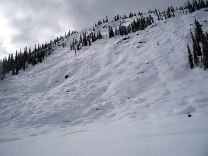
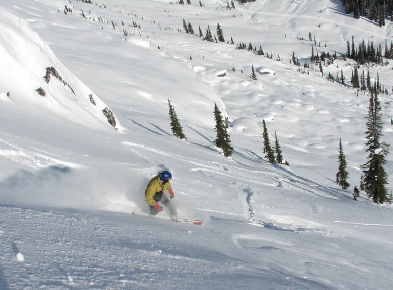
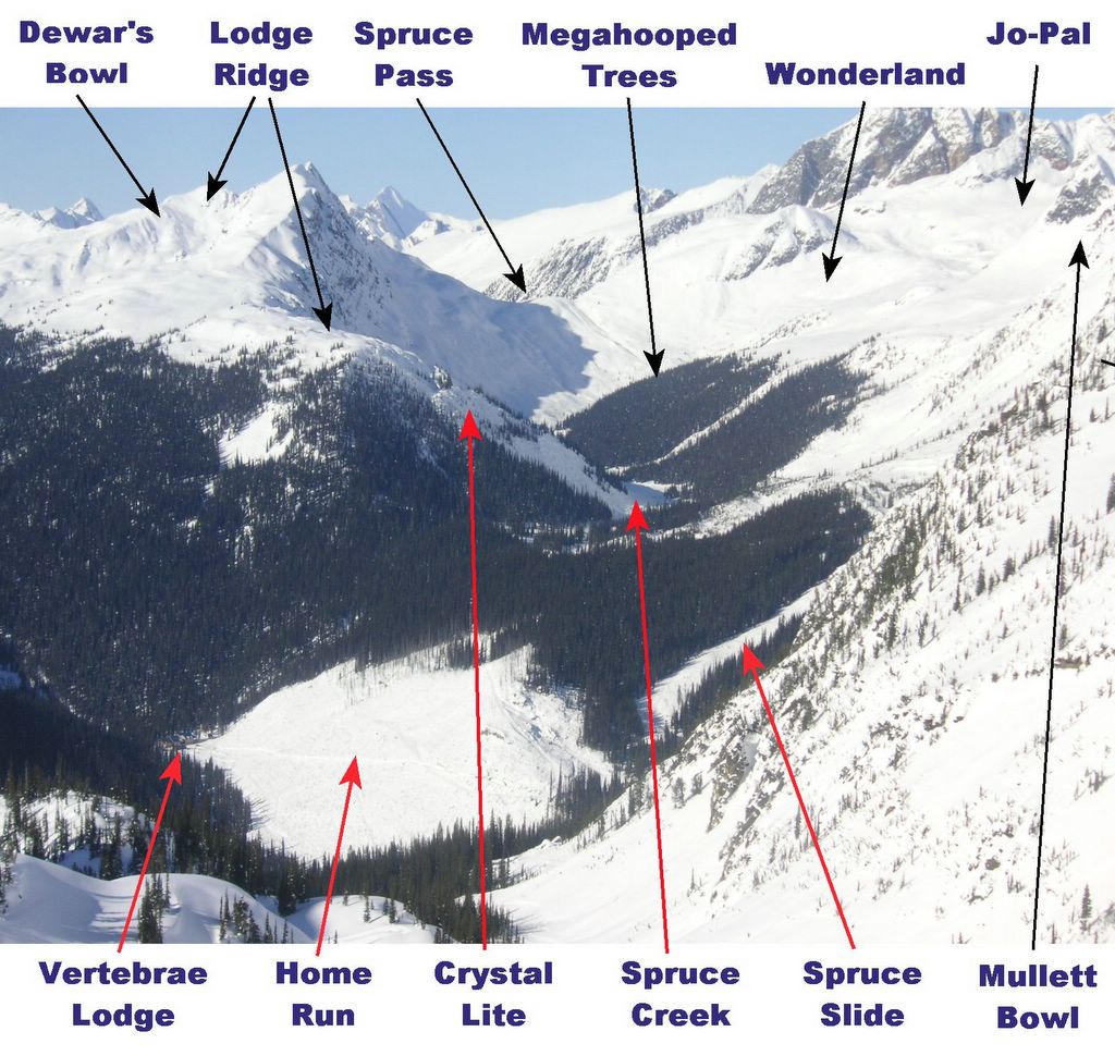
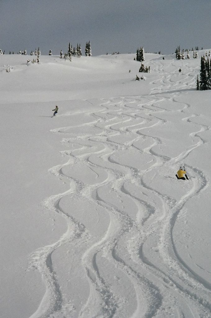
There are three distinct skiing areas on Lodge Ridge. On the east, Mommy's Run and Crystal Lite drop from the lower ridge top into the Spruce Creek gully, below the Megahooped trees. On the south and west there are various tree runs and the "Home Run" cut block. Further north, on the west side, Dewar's bowl provides alpine skiing from the ridge top into the Chatter Creek valley. Even further north on the west side of Lodge Ridge is more alpine terrain that drops into the Chatter Creek drainage, near the Chatter glacier.. In the spring, the Chatter glacier is used for snowmobiling.

Powder Skiing at Chatter Creek
The west side of lower Lodge Ridge . Vertebrae Lodge can be seen at the left corner of the Home Run cut block at the base of the ridge. Click on the two images to the right for a better view of the Home Run. A run to the lodge door on the Home Run is a perfect way to end a day of cat skiing at Chatter Creek..

Megahoop trees are visible towards the top of the photo, just right of center. Beyond the trees, the low point on the horizon at the top of the photo is Spruce Pass. Click here for image with names.

Tuesday, September 07, 2004

Powder Skiing at Chatter Creek
The treeline at the south end of lower Lodge Ridge. The Home Run cut block and Vertebrae Lodge are far below on the left. Visible at the bottom left corner of the photo is the Road to Vertebrae glacier. This is the Spruce Creek gully, between Lodge Ridge and the Megahoop trees. The "Crystal Lite" ski run is in the left-center of the photo and "Mommy's Run" lies to the right hand side.

Powder Skiing at Chatter Creek
The alpine reaches of Lodge Ridge as it passes above the Megahooped trees. From the top of the ridge there are tree runs and much alpine skiing to the west (on the far side of the ridge) and open-slope runs into the Spruce Creek gully to the east. This near-side slope has lots of hummocks that makes for interesting and fun skiing. It's known as Mommy's Run and it's fantastic!

The valley to the west (opposite side)of Lodge Ridge contains Chatter Creek and the Chatter glacier. The Chatter Creek watershed provides a great deal of superb alpine terrain, including Dewars Bowl on the upper (northwestern) reaches of Lodge Ridge. There is also some very nice tree skiing on the west side of upper Lodge ridge. The upper right corner of the photo shows the edge of the Golf Course as it decends from Spruce Pass on the east side of Lodge Ridge.

Click for a view from Lodge Ridge of the cat road to Vertebrae glacier gives a sense of the drop into the gully below the Megahoop trees.

Powder Skiing at Chatter Creek
Below Lodge Ridge, the road to Spruce Pass traverses the photo from left to right. Tracks on the "golf course" running back from Spruce Pass are visible beyond the road. Spruce Pass is out of the photo, to the right.

Powder Skiing at Chatter Creek
Mommy's Run on the east side of Lodge Ridge, facing Megahooped trees. Crystal Lite is beside Mommy's Run, closest to the south end of the ridge and to the left of the photo.

Cat Skiing on Lodge Ridge
Snowboarder and photo contributor Phil Fortier riding on Mommy's Run. The Road to Vertebrae glacier and Spruce Pass is seen at the top of this photo by Bill Frans.

Cat Skiing Terrain at Chatter Creek
Dewers Bowl on the west side of upper Lodge Ridge, in the Chatter Creek watershed. This bowl and slopes above the Chatter glacier can provide many days of excellent alpine skiing. There is also some very good tree skiing in this area.

Powder Skiing at Chatter Creek
The last run of the day, down Home Run, can start at many points on the road to Lodge Ridge. The top of the run is in trees, but it then opens up into the open cut block. The line at far skiers right ends within a snowball throw of Vertebrae Lodge. Lines further to the left end with a short slide down the cat road.

Powder Skiing at Chatter Creek
The base of Lodge Ridge and the end of the Home Run. If you choose the right line, it's sixty seconds from the last turn to the bar!

Powder Skiing at Chatter Creek
Sunset from Vertebrae Lodge. The flank of Lodge Ridge slopes down from the left, the end of the Home Run. Our tracks are still visible in the waning light.
                                        Return to Road Network Index